You won’t find this area marked on the map as district as such, but a look at the road signs you seen see the thread to a name, a wood and there was also a church, but more of that later.
Local history research can sometimes get a bit bogged down with ‘who owned which manor, and who inherited that one..’ You need the history to state the facts, but after a while it just becomes a fog of names, which can get a little bit well boring… I am interested to know who lived where, but finding how a place evolved through maps can keep history a lot more interesting as well as posing more questions…
The Oakley and Deane Parish website history, says in 1392 A.D. that oak trees from a ‘Singet’s Wood’ were harvested and taken by cart to aid the construction on the roof of Winchester Cathedral’s Nave. A staggering 91 carts loads in all! Thats a lot of trees… The area of woodland used was described as being to the east of Oakley, across Manydown towards Wootton St Lawrence. A look on a map now will see pockets of trees in several coppices. Several of these copses you can still walk in and they do retain an old woodland feel which I have written of previously.
The early maps I saw show a ‘Burnt Wood’ -maybe as there was regularly clearing going on in the area? It was obviously a name in circulation for a while.
A Copse…
From the 1800’s a Singins Wood is indicated on maps. Why it was called Sinjuns/Singins/ Sinjins wood is most likely a connection to lands belonging to the Baron St Johns of Basingstoke, a family dating from the Norman conquest. It was quite common in English for this phonetic spelling to mean ‘St. Johns’ – so I’m quite happy to assume ‘Singets’ was just an earlier incarnation of that .
The village of Oakley is still clustered around its farms and the first railway line appears – part of the London to Weymouth line.
St. Johns Lane
So we can say sometime between the 1820′ – 1880’s a new road in Oakley appears, (which was to become ‘St. Johns Lane/Road), marked in Pink below. It also happened to coincide at the time the railways started to came to Oakley, So maybe after – as its 2 bridges have to go over the railway line. ( The older Oakley Lane, it was the railway that went over…)
It appears as ‘St Johns lane’ with the running past the copse that is also named ‘St Johns‘
During the inter war years, Oakley began to grow slowly. On the beneath map is the first recording of St Johns Church which was built around 1914. The road is still called St Johns Lane…
A church…
I never saw St. Johns church like this in its prime… In its relatively short 100 year existence, it had lost it’s lustre by the time I knew it, as the materials weathered! I remember a drab grey outer and the roof was patched up.
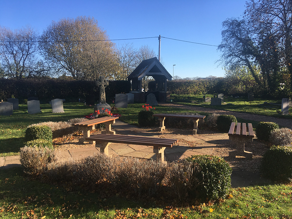
This building was always supposed to be a ‘temporary solution’ for congregational use, but parent St Leonards church, faced with rising costs of upkeep decided to demolish it in 2011. That met with a rather unsavoury reaction from some villagers. Being ‘consecrated ground’ and a place of family burial, I can understand some of the sentiment. Thankfully the dust has settled and villagers now have a remembrance garden which becomes the focal point for the annual act of Remembrance in November.
St. Johns Rd carries on to the Pardown junction in Hill Lane. The building of St. Johns Piece, originally a local housing estate, added to the sense of a district being created as development increased in the 60’s.
The road acts as the eastern boundary to Oakley village, All lorries and buses have to use it to avoid a low railway bridge in Oakley Lane so it can be well used, but I hope the fields and farmland on its doorstep will be allowed to remain so…


Hi Chris thanks for getting in touch.
I don’t claim to be a great authority on the subject, but it was of interest as I drive along it most days.
I’m pretty sure I referenced the sources I had with the names Singets Wood to what looks like Singins wood on the 1826 map – this was the bit that interested me getting to St John’s… please feel free to use mint or check on image usage- I’m sure Hampshire culture Trust would accept an acknowledgment regards